Calvert and Duggan Parks Community Update – Mar 28 2024
Residents living in neighbourhoods near Calvert Park and Duggan Park continue to be concerned about homelessness and encampments in the area. The City of Brampton’s Community Safety and Well-Being Office continues to focus on the area and have provided an update of fire, security and police calls in the area. As well, TRCA has provided an update on flood risks which is a serious safety concern for encampments.
370 Main St N Plaza 2023: 169, Jan 1-March 18 2024: 58
320 Main St N Plaza 2023: 51, Jan 1-March 18 2024: 41
12 Vodden St E Plaza 2023: 30, Jan 1-March 18 2024: 9
330 Main St N Plaza 2023: 40, Jan 1-March 18 2024: 25
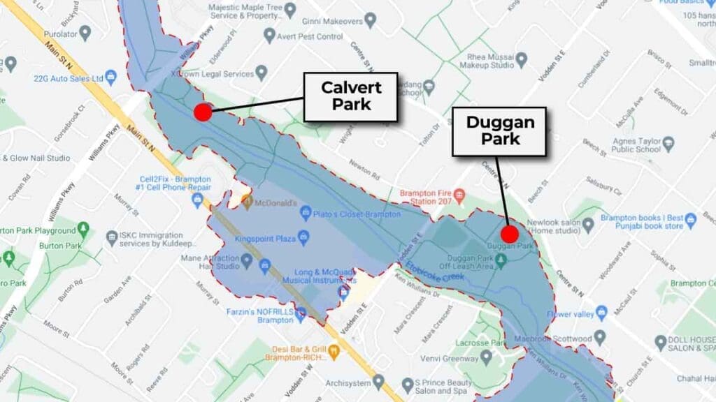
Etobicoke Creek Flood Risk
An ongoing safety issue is the known flood risk along the Etobicoke Creek. At the request on Councillor Santos, the Toronto and Region Conservation Authority (TRCA) provided a flood hazard information update. The TRCA is responsible for creating and maintaining Flood Plain Mapping, and for providing Flood Forecasting and Warning services. See interactive map below. TRCA provided the following update:
Flooding within the Etobicoke Creek valley is a natural occurring process with the degree of flooding increasing as the severity of a storm event increases.
During a 2-year storm event, flows within Etobicoke Creek are expected to begin spilling into the over bank areas adjacent to the channel, between Church Street and Williams Parkway.
Significant flooding of the valley corridor occurs beginning with the 10-year storm event. As storm events increase in severity, flood depths and velocities also increase. During a Regional Storm event, flood depths can reach 3.6 m deep with a corresponding average velocity being 0.94 m/s. These depths and velocities would pose a significant risk to public safety.
TRCA operates a Flood Forecasting and Warning Program which monitors weather forecasts and watershed conditions and issues flood messages to warn of high flood risks. As certain types of storms such as thunderstorms can be difficult to predict, and as the response of river flows to storm events can be sudden, the TRCA advises against allowing people to live in and/or congregate within the floodplain of Etobicoke Creek.
Interactive illustration of the extents of the Regional Storm event floodplain for Etobicoke Creek.